


Calculate Geometry
Purpose
The tool calculates perimeter and area values (including hectares and acres) for polygon layers and length for polyline layers.
After calculation corresponding fields are added to the attribute table of the selected layer and populated with calculated values. If such fields already exist in the attribute table, their values can be recalculated and rewritten to the table.
Description
Only polyline and polygon feature layers can be measured with this tool, point layers are not available for measuring/calculation by this tool.
The "Calculate Geometry" tool allows:
-
Choosing an input polygon or polyline layer
-
Changing and editing output coordinate system by standard ArcMap means
-
Specifying attributes to be calculated: length for polylines, perimeter, area, acres, hectares for polygons
-
Naming new attribute fields
Note:
There is an option to calculate US Survey acres. If you need calculating US Survey acres then select the corresponding option in the XTools Pro Customize window.
Usage
-
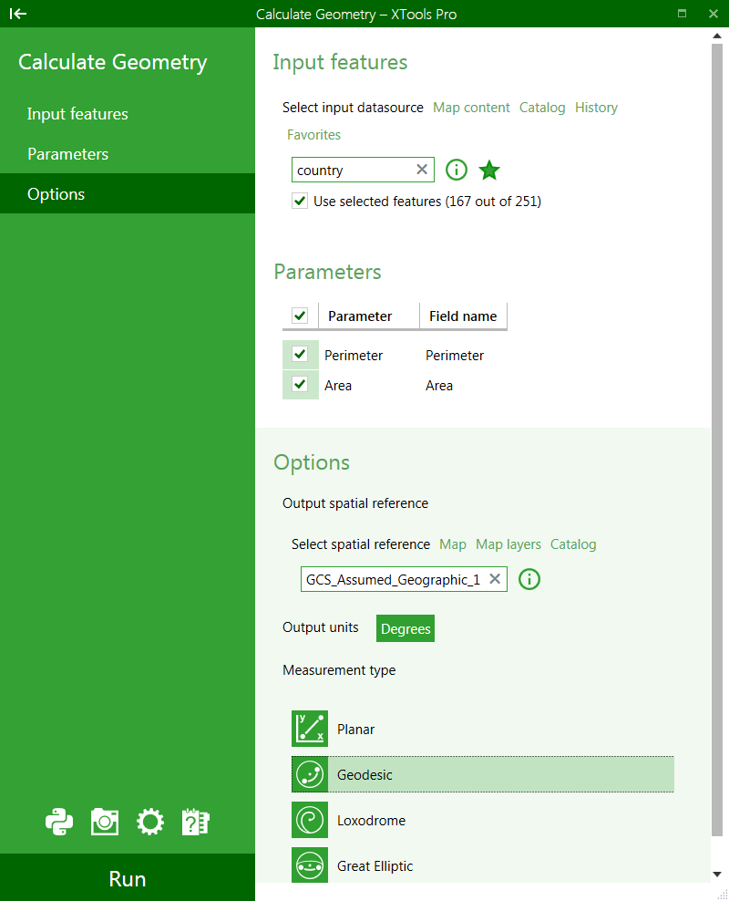
Select the "Calculate Geometry" tool from the XTools Pro Table Operations menu.
-
Select input feature class for calculating geometry parameters.
-
Select the applicable parameters to be calculated.
-
Select the following options:
- Output spatial reference
- Output units
- Measurement type
-
Press Run.
Depending on the selected layer corresponding geometry parameters are available:
-
For polylines "Length" parameter is available
-
For polygons "Perimeter" and "Area" are available
-
For polygons in a projected coordinate system there are "Acres" and "Hectares" parameters additionally available
For linear parameters calculating not only planar but also geodesic, loxodrome, and great elliptic lengths is supported (if a geographic coordinates system used).
Working with coordinate systems
Output coordinate system for the selected input layer can be changed and edited by the standard ArcMap means. Please note that this does not re-project or change coordinate system for the input dataset, output coordinate system and units are used only for calculating length, area and perimeter values.
Input units can be specified for unknown coordinate systems only. The drop-down lists for input and output units are activated if units can be changed for selected input and output coordinate systems.
---