


Add XYZ Coordinates
Purpose
The tool adds X, Y, and Z coordinates to attribute tables of point, multipoint, polyline, and polygon layers. At that there are options to add Z coordinate (only for 3D shapes), specify required coordinate system for output coordinates, and convert angular coordinate units to DMS or DDM formats.
Description
X, Y, Z coordinates can be added to attribute tables of point, multipoint, polyline and polygon layers:
-
For point layers the tool adds X, Y and Z coordinates for all features to the attribute table of the layer.
-
For multipoint layers the tool adds X, Y and Z coordinates for a virtual Center point or real Nearest to center point of all features to the attribute table of the layer.
-
For polyline layers the tool adds X, Y and Z coordinates of the user-defined polyline point for all features to the attribute table of the layer. For polylines coordinates of the FROM, TO, or Center point can be added.
-
For polygon layers the tool adds X, Y and Z coordinates for a Center or Label point of all features to the attribute table of the layer.
Usage
-
Select the "Add XYZ Coordinates" tool from the XTools Pro Table Operations menu.
-
Select input feature class for adding coordinates.
-
Select coordinates to be added.
-
Select the following options:
- Source point location
- Output spatial reference
- Angular units format
-
Press Run.
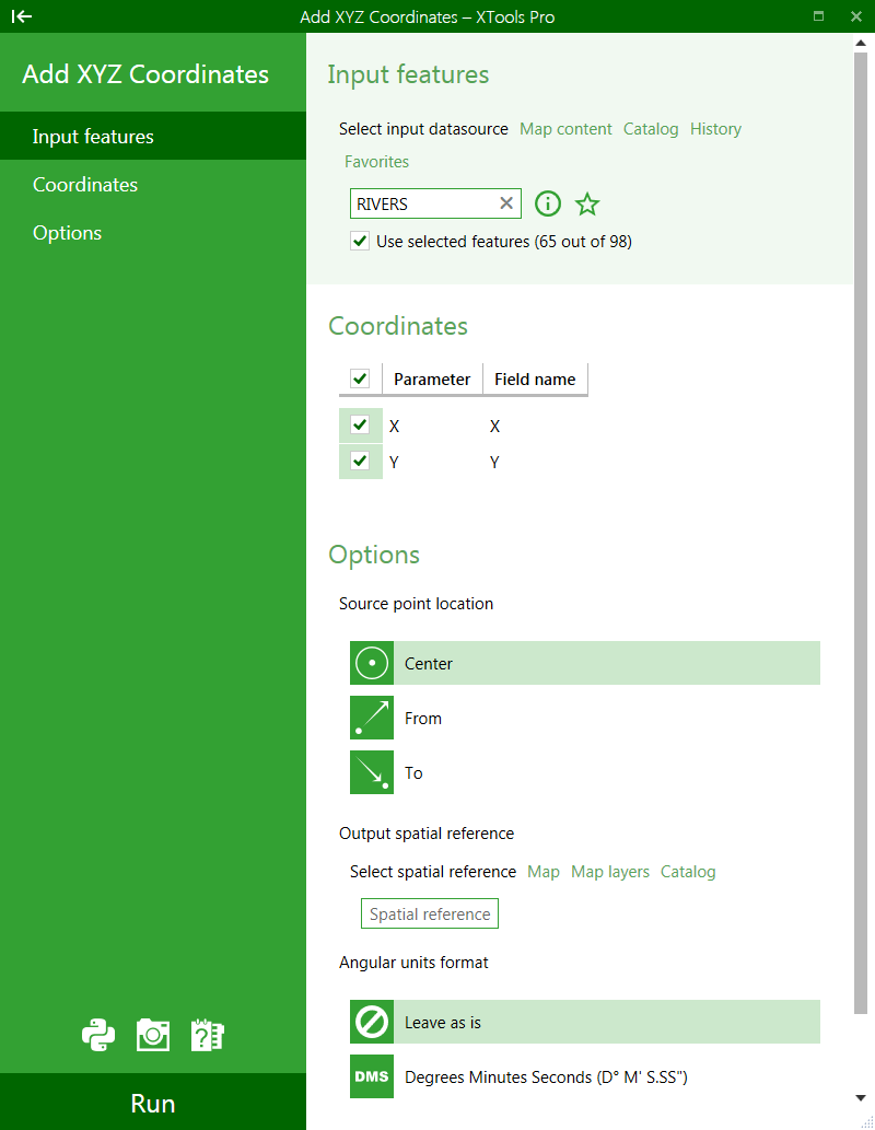
The functionality of the tool allows naming fields that will store coordinates in the attribute table. By default these fields are named X, Y, Z. To name a field, enter a name instead of the default name into the "Field name".
To select coordinates to be added to the attribute table, mark the corresponding checkboxes for the required coordinates. If a checkbox is not marked the respective coordinate will not be added to the attribute table.
Please note that Z coordinate is added only for 3D shapes, i.e. feature classes with Shape field having Z attribute.
Selecting output spatial reference
A new output projection can be selected and used to output coordinates in another coordinate system. The projection (coordinate system) can be changed by standard ArcMap means if you press the gray "globe" button. If you don't need to output coordinates in another coordinate system then simply remove selected output projection.
Please note that data itself is not projected by using another output projection, this is applied only to the output X and Y coordinates.
Converting angular units to DMS or DDM format
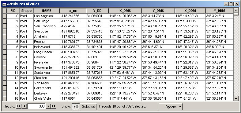
This option allows converting coordinates in decimal degrees (DD) into DMS (D° M' S.SS") or DDM (D° M.MM') format. Note that in this case output fields are always TEXT. Example demonstrating output X and Y coordinates in DD, DMS, and DDM formats:
---