


Extract Raster Zonal Statistics
Purpose
The tool is meant for extracting statistics from raster datasets at the zones defined by the selected polygons.
Description
The Extract Raster Zonal Statistics tool requires two input datasets, a raster dataset and a polygon dataset. Statistical summary of the raster dataset values covered by the zonal polygons will be written to the same input polygon as new attributes or output as a new table.
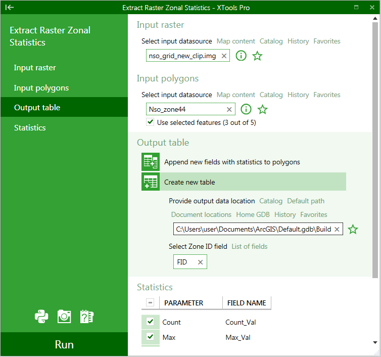
Usage
-
Select the "Extract Raster Zonal Statistics" tool from the XTools Pro Surface Tools menu.
-
Select input raster to extract zonal statistics from.
-
Select polygons defining zones for which statistics will be extracted from the input raster.
-
Select if the extracted statistics will be appended as new fields to the input polygons attribute table or a new table will be created.
-
In the latter case specify the new output table and select the Zone ID field from the input polygons.
-
Select statistics for extraction and modify output field names if required.
-
Press Run to extract zonal statistics.
Note:
If selected input polygons do not overlap any part of the input raster containing data (for example, polygons cover only NoData cells or do not overlap raster layer at all), then "-999" value is written to the fields in the output table indicating NoData. Besides, same "-999" values are assigned to the non-processed polygons in cases when selected features are used for processing.
---