


Density
Purpose
This tool is provided for creating density raster maps.
Description
The tool allows calculating density rasters for point and polyline features in a specified neighborhood. You can use the tool to calculate density for landmark points and lines, utility and transportation lines etc.
Usage
-
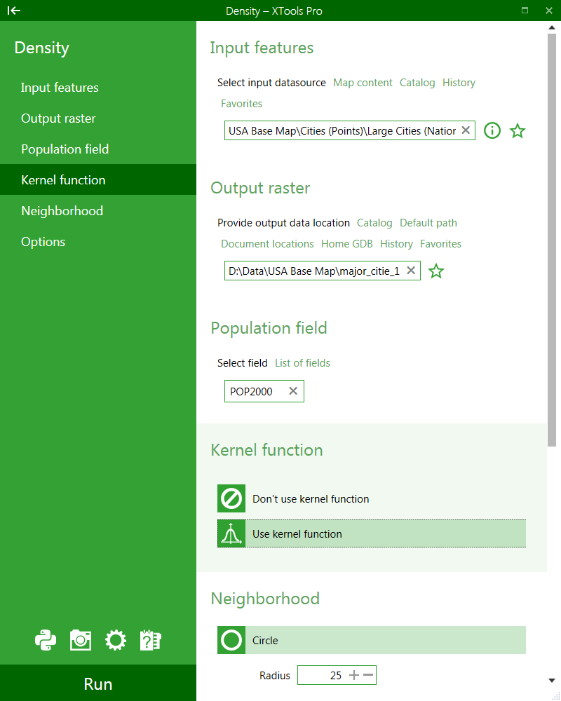
Select the "Density" tool from the XTools Pro Surface Tools menu.
-
Select the input layer containing points or polylines to calculates density for.
-
Specify the name and location of the output raster dataset.
-
Select an appropriate population field.
-
Select if you wish to use Kernel function.
-
Specify neighborhood and its parameters.
-
Specify cell size and area units.
-
Press Run to calculate density raster.
Kernel function.
Using kernel function is the default option. Being available for only Circle and Ellipse neighborhood types it allows using a kernel function to fit a smoothly tapered surface to each input feature.
Neighborhood types.
There are following neighborhood types available.
-
Circle
- a circular neighborhood with the given radius.
-
Ellipse
- an elliptical neighborhood with the specified major/minor radius and rotation angle.
-
Annulus
- a torus (or donut) neighborhood defined by an inner radius and an outer radius.
-
Rectangle
- a rectangular neighborhood with the given width and height.
-
Wedge
- a wedge (pie) neighborhood. A wedge is specified by a start angle, an end angle, and a radius. The wedge extends counterclockwise from the starting angle to the ending angle. Angles are specified in arithmetic degrees (counterclockwise from the positive x-axis). Negative angles may be used.
Unlike the standard functionality for calculating density in ArcGIS this tool combines all Density options.
---