


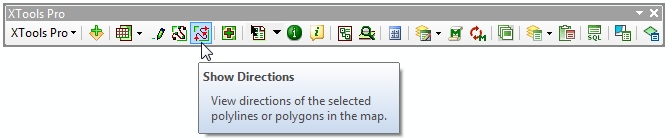
Show Directions
Purpose
The Show Directions tool is provided for displaying directions of polyline and polygon features.
Description
Each vector polyline or polygon feature has its own direction. Usually this is the direction in which features are initially digitized.
Knowing feature direction can be useful in various GIS tasks, for example, tasks related to networks such as routing, hydrological modeling, for displaying flow directions etc.
Using "Show Directions" tool
The icon of the Show Directions tool is active if there is at least one polyline or polygon layer selected in the TOC window:
To display directions click the Show Directions icon on the XTools Pro toolbar, and direction arrows of all features of the selected layer will appear. If there are selected features in the selected layer(s), direction arrows will be displayed for the selected features only. If there are a few polyline and polygon layers selected in the TOC window, direction arrows will be displayed for all the selected layers.
To turn directions off, simply click again the Show Directions icon on the XTools Pro toolbar.
Direction arrow symbols are represented as graphic objects in the ArcMap Data View. By default direction arrows are represented with red color. At that, direction arrow symbols size, interval and color can be customized.
---