


MultiRename Datasets
Purpose
If you ever faced the need to rename multiple datasets in ArcGIS you might realize those limited capabilities available with ArcGIS out of the box. In order to fill this gap there is a new MultiRename Datasets tool provided in XTools Pro.
There are numerous and countless scenarios that can be foreseen and that are now addressed and supported: modifying names adding characters, adding counters, replacing parts of names, replacing datasets names with their layer names, adding geometry types to the datasets names and a lot more. All that now can be easily and promptly done (and undone, if required) with XTools Pro.
Description
The MultiRename Datasets tool is aimed to help you with changing names of your ArcGIS datasets providing multiple advanced options and masks.
This is not a conversion tool so the extensions are not altered, all the work is made with the datasets names.
Following types of data are supported:
- Shapefiles
- Standalone tables
- Geodatabase feature classes and tables
- Raster datasets
Renaming multiple datasets
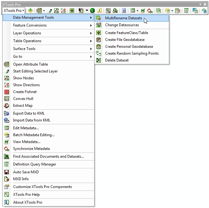
The tool is available from the Data Management Tools menu, no matter if there is a map open or any data currently added in ArcMap:
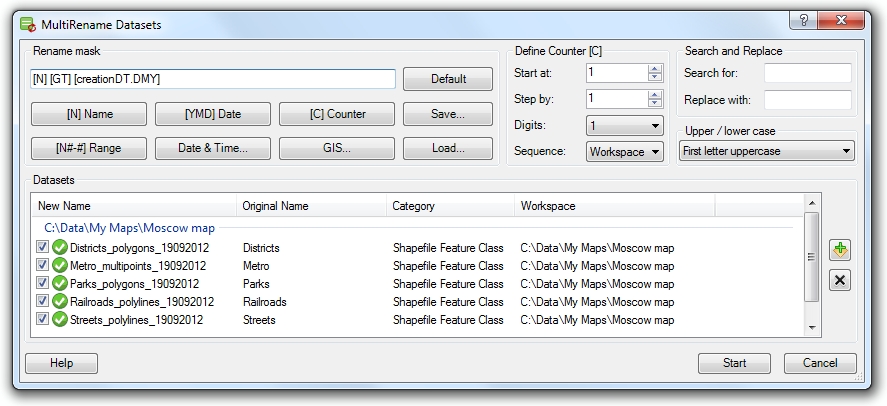
The tool dialog window consists of the following main parts:
-
Rename mask field
-
Buttons allowing to add renaming components
-
List of datasets for renaming
Renaming datasets
Datasets to rename can be added in a few ways - with a Smart Add Data dialog using the button on the left, drag and dropped from the Catalog window or from the current map.
Renaming selected datasets you can create and use renaming masks consisting of various components.
Renaming may consist of:
-
[N] Name
- contains original dataset name, this is the default mask
-
[N#-#] Range
- contains specified range of letters from original dataset name
-
[YMD] Date
- contains creation date of original dataset in YMD format
-
Date & Time...
- this can be either creation date and time or current date and time in various formats and combinations
-
[C] Counter
- contains a counter for the selected datasets. Counter properties can be defined using separate controls on the right.
-
GIS...
- this can be [LN] layer name, [GT] geometry type, [GDB] geodatabase name (supported only for file and personal geodatabases), [SR...] spatial reference, [D...] datum or [U...] units (for the latter three options you can select name, abbreviation or alias).
Renaming components can be added using buttons or entered manually, at that please note that everything you enter in the rename mask is case sensitive.
Rename masks can be saved and loaded for use later in another renaming sessions.
Defining counters
Using counters in renaming mask you can change and specify the start number, increasing step, number of digits and also the sequence for the counter.
Search and replace
Renaming datasets you can search and replace certain letters/numbers or combination of them in the input names.
Changing names case
Changing case without actually changing the original names is only possible for shapefiles and .dbf standalone tables.
Renaming summary
For the renamed datasets there is a renaming summary provided where you can see what layers successfully renamed and what layers failed:
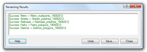
For the renamed datasets you can:
-
Save results summary to file (.txt or .rtf)
-
Undo renaming for all renamed datsets
---