


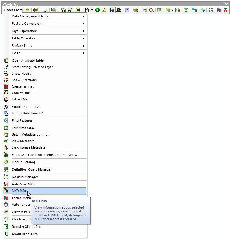
Note: this tool is updated in XTools Pro 16.1
MXD Info
Purpose
The MXD Info tool is provided for viewing and editing information about MXD documents without actually opening them in ArcMap. At that, there is an option for defragmenting MXD documents.
Description
Working with spatial data and maps sometimes you may need to see and maybe change the details about a map in a convenient way, in one place. Something like what you see in ArcMap Document Properties but in even more details. At that, you may wish to see this information about MXD document without opening this document - it may happen it is a wrong MXD document and you don't need to open it. Besides, some MXDs may take really long to open.
And sometimes you may need to defragment your MXD as with time they tend to become a real mess internally. You don't see it directly, but you can experience it - you can feel how longer it takes to open, and you can see how larger the MXD file is getting with time.
Retrieving information about MXD documents
The MXD Info tool is always available from the XTools Pro toolbar drop down menu or from the XTools Pro Navigator as soon as you activate the XTools Pro extension. It can also be placed as a button on the XTools Pro toolbar for easier access.
When you run the tool by default it shows information about the currently open map document in ArcMap. Besides, you can also select any other MXD document from the disk. This way you can retrieve information about an MXD document without actually opening it.
At that, there is a list of the recent map documents available so you can promptly access map documents you already worked with before:
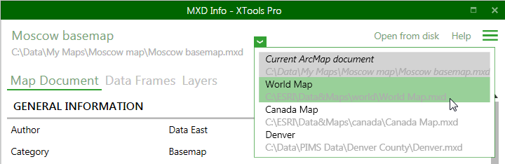
This is similar to the ArcMap recent map documents, but the list is unique for the tool and separate from the ArcMap recent map documents.
MXD Info dialog consists of three main tabs:
-
Map document
- here you can see general information about map document, similar to what you get with the Map Document Properties dialog in ArcMap
-
Data frames
- in this part you can see all data frames (maps) and their properties in map document
-
Layers
- in this part you can see all layers and their properties in the map
Map document
Following information about MXD documents is provided by the MXD Info tool:
-
General information
- includes details that you can get from the Map Document Properties in ArcMap:
- Author (editable)
- Category (editable)
- Description (editable)
- Credits (editable)
- Hyperlinks (editable)
- Tags (editable)
- Save preview (editable)
- Summary (editable)
- Title (editable)
- Relative paths (editable)
- Default geodatabase
-
Date
- shows dates when the map document was created, modified, accessed, last saved, last printed and last exported
-
Initial data
- provides ArcGIS version and template/styles used in the map document
-
Maps
- shows data frames in the map document
-
Layers that may cause rasterization
- lists map layers that may cause rasterization when printing or exporting map, indicating the reasons for rasterization, e.g.:
- Layer transparency
- Raster-based picture symbols
- Field-based transparency
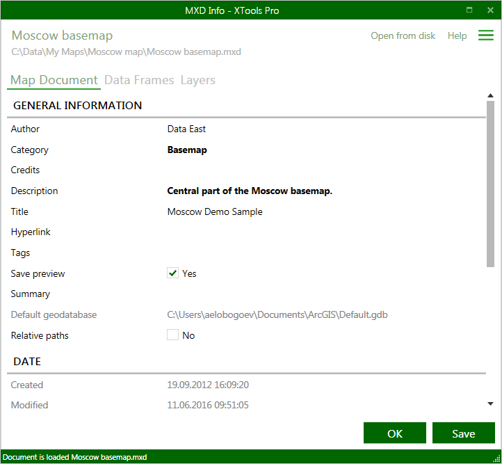
Note: "Save preview" parameter is only available for map documents currently open in ArcMap.
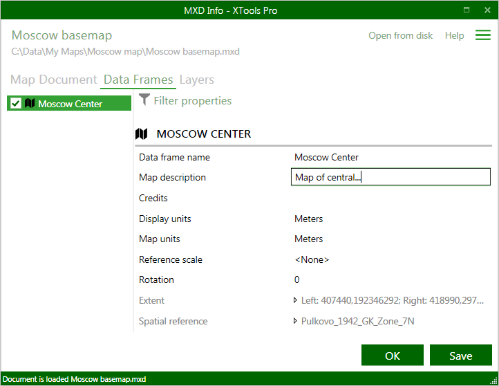
Data frames
Following information about data frames is provided by the MXD Info tool:
- Map (data frame) name (editable)
- Map description (editable)
- Credits (editable)
- Display units (editable)
- Map units (editable)
- Reference scale (editable)
- Rotation (editable)
- Extent
- Spatial reference
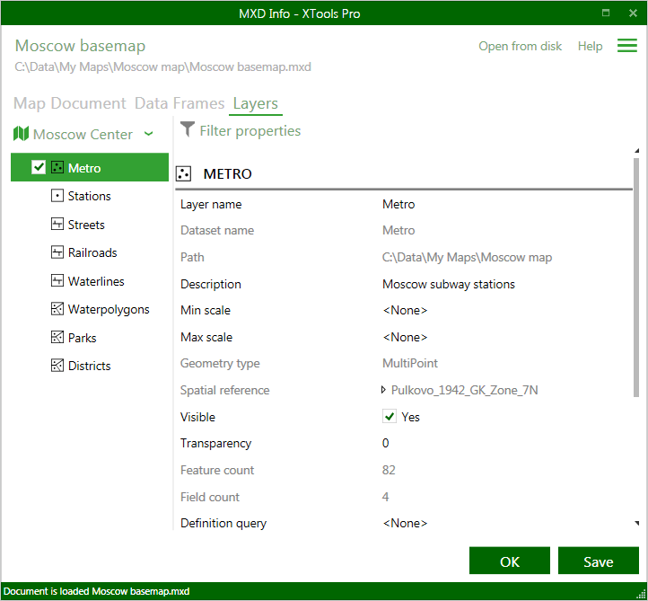
Layers
Following information about layer is provided by the MXD Info tool:
- Layer name (editable)
- Dataset name
- Path
- Description (editable)
- Min scale (editable)
- Max scale (editable)
- Geometry type
- Spatial reference
- Visible (editable)
- Transparency (editable)
- Feature count
- Field count
- Definition query (editable)
- Labels (editable)
- Z values
- M values
- Times
- Relates
- Joins
- Transformation
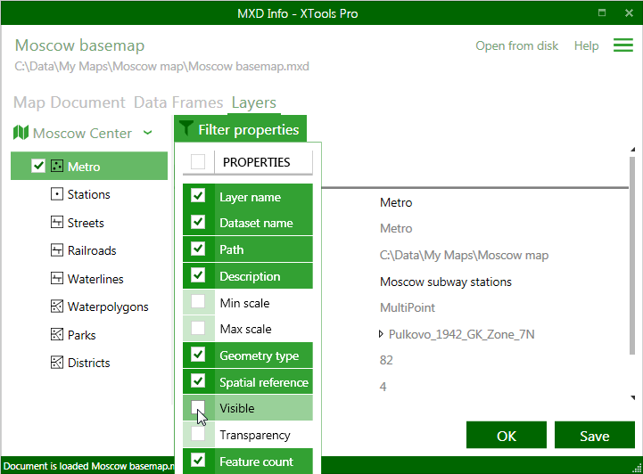
For more convenient work both data frame and layer properties can be filtered so you can only those properties you are interested in at the moment:
Other operations
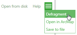
There are following additional operations available for map documents:
-
Defragmenting
- MXD Info allows defragmenting map documents loaded from disk
-
Opening in ArcMap
- if you opened a map document from disk you can select to open it in ArcMap
-
Saving to file
- map document properties and details can be saved to a file on disk, text and HTML formats supported.
For the map documents currently open n ArcMap you can apply edits and changes and then save them with map document itself. For the map documents loaded from disk you can save edits and changes directly in the MXD Info dialog window.
Defragmenting MXD documents
The MXD Info tool allows defragmenting the storage in ArcMap MXD documents in order to reduce the file size. This can be especially useful if you see that your MXD files become too large.
To defragment the MXD document just open it in the MXD Info window and select Defragment from the menu next to the Help button. A new MXD file with the _defrag.mxd name will be created in the same folder as the original MXD. This way a new file is always created after defragmentation procedure and the original MXD is not affected.
Note: defragmenting functionality can also be applied to .mxt template files.
---