


Working with GeoRSS in ArcGIS
Purpose
GeoRSS is an emerging standard for encoding location as part of a Web feed. (Web feeds are used to describe feeds ("channels") of content, such as news articles, Audio blogs, video blogs and text blog entries. These web feeds are rendered by programs such as aggregators and web browsers.) The name "GeoRSS" is derived from RSS, the most known Web feed and syndication format.
In GeoRSS, location content consists of geographical points, lines, and polygons of interest and related feature descriptions. GeoRSS feeds are designed to be consumed by geographic software such as map generators. By building these encodings on a common information model, the GeoRSS collaboration is promoting interoperability and "upwards-compatibility" across encodings.
XTools Pro brings support for GeoRSS to ArcGIS.
Description
GeoRSS is supported in two ways with XTools Pro. First, XTools Pro adds an additional GeoRSS Connections node to Catalog. Here you can connect to the GeoRSS feeds and bring published data from these feeds to the maps. Then, there is an Export Data to GeoRSS tool in the XTools Pro toolbox.
Adding GeoRSS feeds to ArcGIS
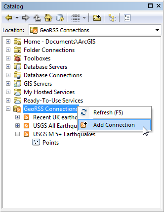
In order to add a new GeoRSS feed right-click on the GeoRSS Connections item in the Catalog window and select to Add Connection.
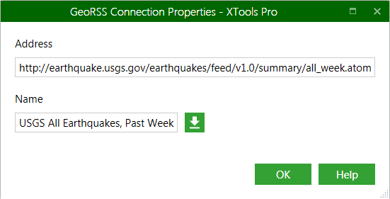
In the GeoRSS Connection Properties window specify the address and name for the new connections and press OK. Name can be derived from the specified GeoRSS feed.
GeoRSS data from the connection can be added to the map for viewing the published features and its' attributes. From the map these data can be exported to the other ArcGIS formats using the standard ArcGIS capabilities.
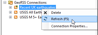
As GeoRSS connections usually represent the "news" feeds its' content may be updated so when you see a small green dot on the connection icon this means the content has changed and you may wish to refresh the connection.
---