


Find Associated Documents and Datasets
Purpose
Cleaning up data on disk? Wondering where is this particular dataset used? Do you still need it or it can be removed without leading to broken links to datasets in some MXDs? Or, need to know what datasets used in this mxd and where they are located? The new tool is provided for searching for map documents associated with the selected dataset or finding datasets used in the selected map document.
Description
The new Find Associated Documents and Datasets tool is aimed to help you organize and better understand your data and maps. With this tool you can find in what ArcGIS map documents (mxd, mxt, lyr etc.) the selected dataset is used, or what datasets used in the selected document.
Usage
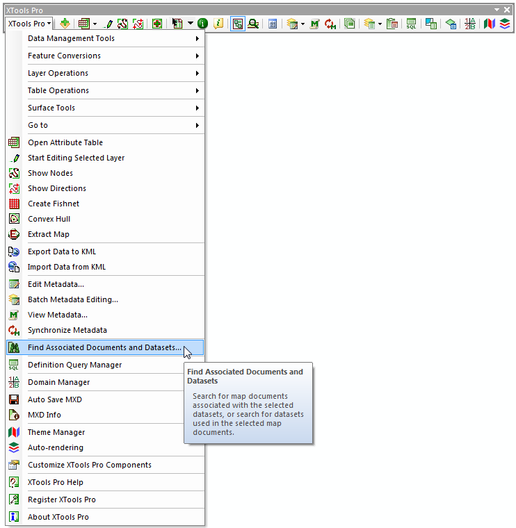
The tool is available from the main dropdown menu, no matter if there is a map or any data currently open in ArcMap:
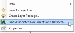
Another way is running the tool from the context menu of a layer or a dataset in the Table of contents or Catalog window in ArcMap. In this case the selected item will be automatically added in the dialog as a dataset for which you can search for associated map documents or as a map document.
The dialog consists of two main tabs and a search results window in the bottom:
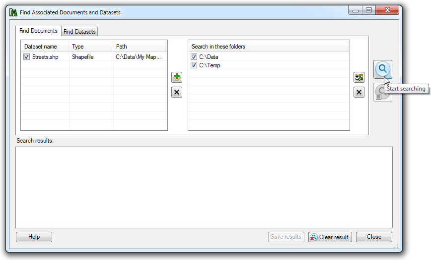
Searching for map documents associated with selected datasets
Searching for associated map documents you can add as many datasets as you need, search results will be then grouped by the datasets. Datasets can be added manually from the TOC or Catalog windows or using the Smart Add Data dialog. On the right side you can select folders where the tool will search for map documents. You can specify the entire disk (C:\) or you can add a specific folder. The search is independent of the connected folders in ArcGIS, and you can add folders from the mapped drives and shared folders from the local network (any folder that you browse with the dialog).
Analyzing datasets the tool considers a combination of dataset name, type and workspace parameters.
Supported map documents are:
-
ArcMap documents (mxd)
-
ArcMap templates (mxt)
-
ArcGIS layer files (lyr)
-
Published map files (pmf)
-
ArcGlobe documents (3dd)
-
ArcScene documents (sxd)
-
ArcScene templates (sxt)
The tool will search for these types of map documents in the specified search folders.
Having selected datasets and search folders you can finally press the magnifying glass on the right to actually start searching. The search process can be stopped at any time, for example, after the first item is found and displayed in the search results window.
The search is based on the index file which is stored locally in the user's profile folder. Index is built and updated each time you run search. As a result, depending on what search folders you specified, it may take longer for the first search. But then, especially if you usually use the same folders to store data and maps, it will search much faster. At that, the tool scans for any changes in the indexed folders and updates its index accordingly.
Searching for datasets associated with selected map document
Same way as you search for map documents you can search for the datasets used in the selected map document. The tool will show all datasets found, in any format (including SDE geodatabases and GIS Servers) that you can access with your ArcGIS.
Working with search results
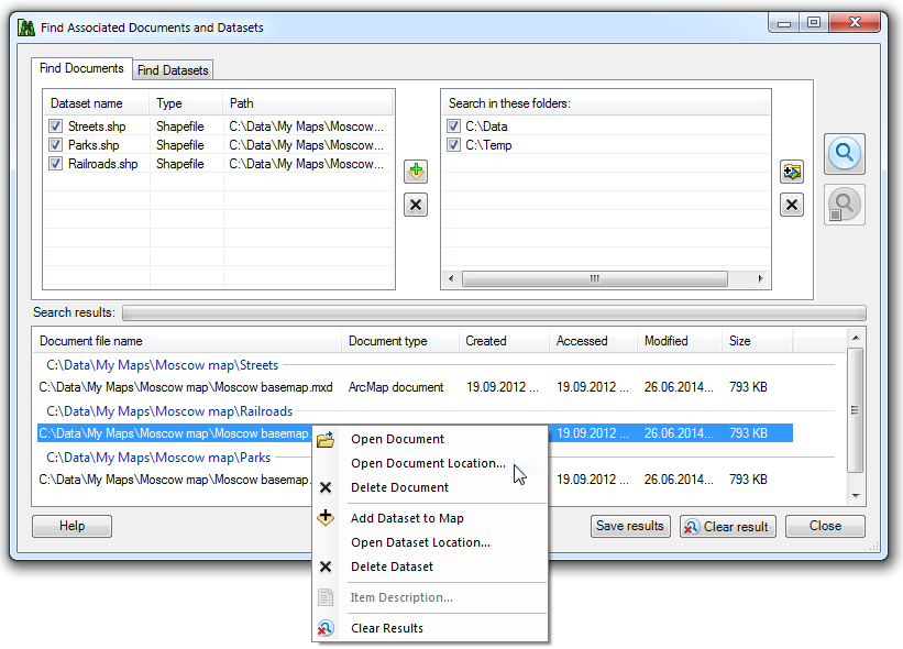
For each item in the search results window there is the same context menu. For the found map documents you can:
-
Open document
- opens map document with the associated application
-
Open document location
- opens the document location with Windows Explorer
-
Delete document
- permanently deletes document file from disk
For the found datasets you can:
-
Add dataset to map
- adds selected dataset to the current map
-
Open dataset location
- opens the dataset location with Windows Explorer
-
Delete dataset
- permanently deletes dataset file from disk
-
View item description
- opens the ArcGIS item description
Datasets found in the selected map document but being unavailable at the moment for some reason (e.g. lost datasources, no access to SDE tables) are displayed in gray in the search results window. You cannot add such datasets to map, delete them or open their location on disk.
Search results can be saved to a TXT or HTML file.
---