


Make Polygons from Points
Purpose
The tool allows converting points from the point layer to one or multiple polygons. Resulting polygons can be saved in a new shapefile or as a geodatabase feature class.
Description
The tool is provided for making polygon(s) from the input points. At that, no intersecting or cleaning is done, so the user must do the appropriate preparatory work (if necessary) prior to using the command in order to get appropriate results.
Usage
-
Select the "Make Polygons From Points" tool from the XTools Pro Feature Conversions menu.
-
Select the input layer containing points that you wish to convert to polygons.
-
Specify the name and location of the output feature class.
-
Select the Group by field to group input points and create multiple output polygons.
-
Specify the Order by field to connect input points in the required order.
-
Specify tolerance if required. This is the minimum distance that may be separating input points coordinates.
-
Press Run to convert points to polygons.
Grouping input points by a field allows to create multiple polygons specifying a grouping field by which input features will be grouped.
Ordering input points by a field allows to specify order in which points will be connected while creating polygons. This option can be used if input features ordering is known and is required to be taken into account. By default it is not used. As an example, ordering can be defined by the FID field (digitizing order).
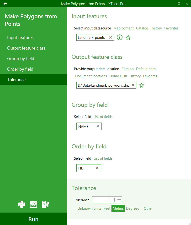
Example:
Input points are ordered as labeled below:
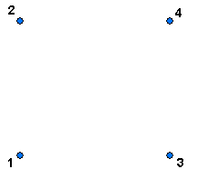
Polygon made without using input features order:
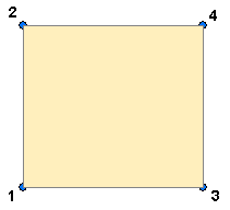
Polygon created using input features order:
---