


Convert Polygons to Polylines
Purpose
This tool converts selected polygons to single part polylines and stores them in a new shapefile or geodatabase feature class.
Description
This tool is aimed to the conversion of the selected polygons to single part polylines. If no polygons are currently selected, all polygons in the layer will be processed. Source polygons can be single or multipart features. The output polyline attribute table will consist of either the same fields as one of the input polygons, or will contain only IDs of the left-side and right-side polygons depending on the selected option.
Usage
-
Select the "Convert Polygon to Polylines" tool from the XTools Pro Feature Conversions menu.
-
Select the input layer containing polygons that you wish to convert to polylines.
-
Specify the name and location of the output feature class.
-
Select how adjacent polyilnes should be split.
-
Specify ID field to store input features IDs.
-
Press Run to convert polygons to polylines.
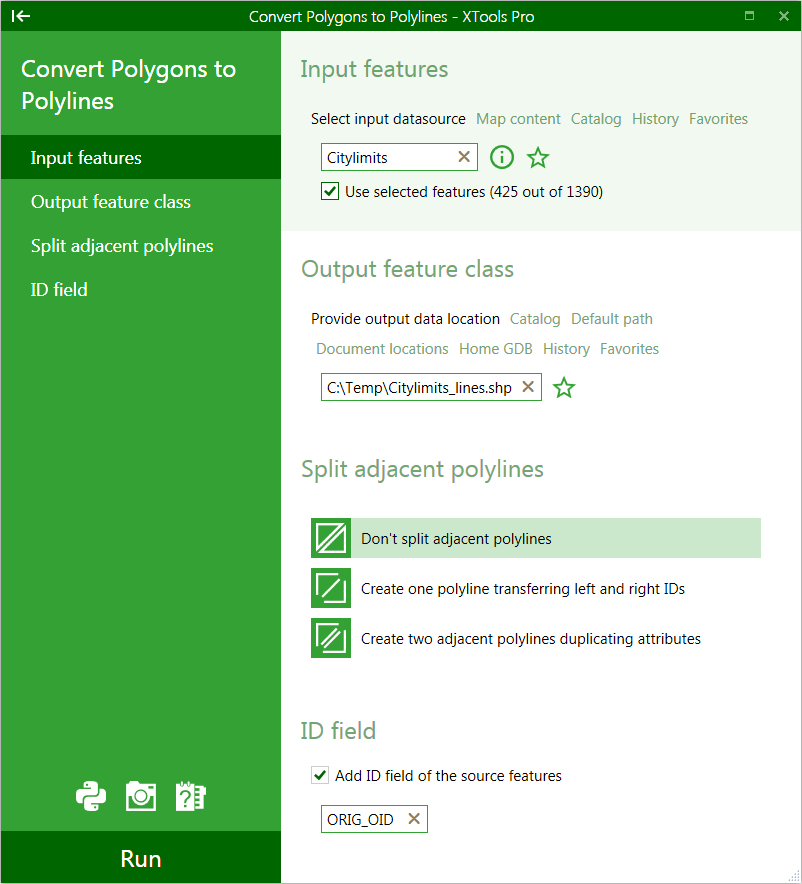
There are three options available for splitting adjacent polylines that may result from the adjacent polygons:
-
Don't split adjacent polylines
- polylines will be left as is
-
Create one polyline
- IDs of the left-side and right-side polygons will be transferred to the output feature class table
-
Creating two adjacent polylines
- attributes will be duplicated in the output feature class
---