


Create Fishnet
Purpose
XTools Pro Create Fishnet is an advanced and powerful tool for creating fishnet feature classes.
Description
Create Fishnet builds fishnets of rectangular or hexagonal cells. Rectangular fishnets can be created as polygons or polylines while hexagonal fishnets are always polygons.
Creating Fishnets
-
Select the "Create Fishnet" tool from the XTools Pro menu.
-
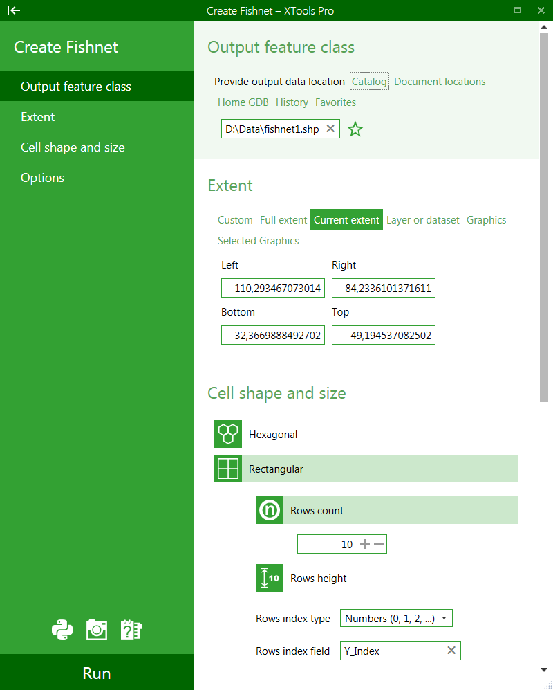
Specify the name and location of the output fishnet feature class.
-
Select the extent for the fishnet cells.
-
Define fishnet cell shape and size.
-
Specify additional optional parameters:
- Fishnet geometry type: polygon or polyline
- Fishnet rotation angle
- Clipping fishnet cells using overlay features
-
Press Run to create a new fishnet.
Specifying extent
Following options are available for the extent:
- Any custom user defined extent
- Full map extent
- Current map extent
- Selected layer or dataset extent
- Selected graphics layer or selected graphic elements extent
Selecting fishnet type
For the new fishnet either rectangular or hexagonal cell shape can be selected.
Adjusting rectangular cells
Rectangular fishnet cells are adjusted by defining a number of rows and columns or by specifying height and width size for a cell:
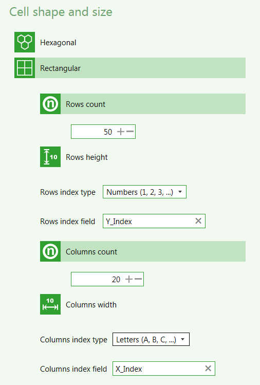
Fishnet cells can be indexed. At that there are three styles provided for cells indexing. Indexes can be (in direct or reverse order):
- Letters
- Numbers starting with 0 (0,1,2...)
- Numbers starting with 1 (1,2,3...)
Adjusting hexagonal cells
Hexagonal fishnet cells are adjusted by specifying cell's edge length, or radius of inscribed circle, or cell area:
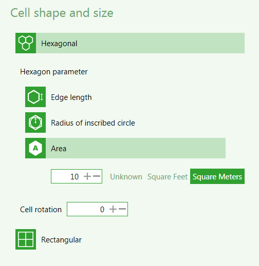
Note that you can define only one of these parameters, the others are recalculated accordingly. There is no way to define the number of output cells, the tool will create as many as fit the specified parameter.
Indexing is not available for hexagonal cells, but there is an option to rotate cells (in addition to rotating the whole fishnet).
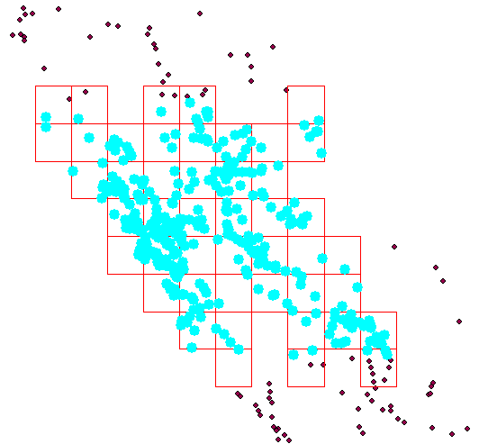
Clipping output cells
Fishnet cells can be clipped by the specified overlay layer. Overlay layer can be any point, polyline or polygon layer added in the map. As well, only selected features of the overlay layer can be used.
NOTE: this option for clipping output cells is only available if fishnets are created as polygons.
Using this option you can generate fishnets consisting only of those cells that overlap specified certain layer features, as shown in this example below:
Rotating fishnet and saving results
Output fishnet can be rotated by a specified angle. Rotation is performed in a clockwise direction. Rotation angle can be any values, negative values allowed. Negative angles can be used to rotate cells in a counterclockwise direction.
Output fishnets can be saved either as polygons or polylines, in a shapefile or geodatabase format. Hexagonal cells can be saved only as polygons.
---